One of the many reasons I love my dad

It finally feels like Fall in Colorado and after a long, hot summer this is the time of year I enjoy the most. Well, with the exception of winter’s glorious snow. And who doesn’t love spring blossoms?

OK, mostly I just hate summer’s heat.

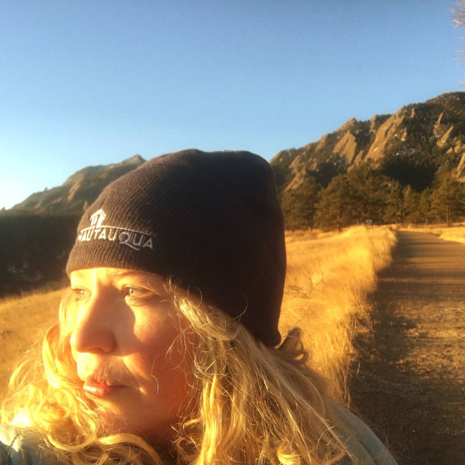
As a part of my physical therapy, I’ve been trying to bike daily. Though I don’t yet feel I’m ready to hike, my knee is getting stronger every day. Yesterday, I biked for over an hour and was delighted, upon summiting a large hill on the Ralston Creek Trail, to have a vantage point of two gorgeous lakes.

But even better was I actually passed a young dude on the trail, evidence I’m finally gaining some speed. “This is the stretch that always gets me,” he mumbled as an excuse. “Yeah, me too!” I breathed as I raced by.

Or not.

Dear ol’ dad posted the following as his Facebook status last weekend:

Passed these two teenagers pushing their mountain bikes up the Southland Drive hill.

’70-year-old guy passing on your left,’ said I.

‘Heh, heh,’ said they in obvious humiliation.

Just in case you’re wondering where I get “it” from.

The coolest kids adventure race on the planet: in pictures

On Saturday, Hadley competed in the KEEN Vail Kids Adventure Race. I was devastated to miss it due to my hospital stay but had a blast “training” her and our neighbors (who also competed). Over the last few weeks, we hiked, biked and zip-lined all over Denver.

But nothing could have prepared them for the adventure race, which was so much more challenging and exhilarating than they could have imagined. Since I wasn’t there, I was grateful to my friend Jennefer who let Haddie stay with her overnight and took pictures of their great adventures.

=========

The Race

Introducing: Team Adventure Girls with Sydney and Hadley.

Off the starting block. Girls vs. boys, neck and neck (Haddie and Syd are on the left).

At one point partway through the race, Hadley and Sydney started to pass a boy’s team, which prompted the chauvinistic father to shout at his son, “If you let that happen, I will never enter you in another race again!”

I will include Boy Domination in next year’s training.

There was a tunnel through the river that later included a huge obstacle the girls needed to haul their bikes over.

There were plenty of volunteers to assist in the transition areas. The girls were in charge of keeping track of their map and getting a stamp at each station in order to move onto each new challenge.

Sydney was a fantastic teammate, frequently helping and encouraging Hadley throughout the race like this ropes course.

Slip slidin’ away! (Haddie’s favorite part).

Official hiking trails?

Adventure racers don’t need no stinkin’ hiking trails. They go straight up the mountain.

But they do need a zip-line to race back down.

The tubing portion was a nice reprieve from Vail’s toasty temperatures.

I know it’s not kosher to pinch hardcore adventure racer’s cheeks but that’s what I want to do when I see this cute picture.

Haddie also told me about the “little waterfalls” they went down.

I didn’t have the heart to tell her they’re called rapids.

Of course, what would an adventure race be without a climbing wall….

…and a mud pit to finish things off right?!

Or just really, really dirty.

Haddie had a blast competing in the KEEN Vail Kids Adventure Race. Was it a cakewalk? Definitely not. In fact, some sections of the course (particularly the mountain biking) would have been a challenge for adults. Despite being an adventurous kid, a couple of times she was freaked out to the point of tears.

But the greatness of a race like this is it yanked her out of her comfort zone where, in a controlled environment with capable volunteers, she challenged herself. I realized as parents, we shelter out kids too much and often don’t let them realize their true potential because of our own insecurities.

Hadley overcame her fears and has not stopped talking about the race. In a word, she triumphed.

And you’d better believe come hell or high water (or hospitals) I’ll be there to watch her do it again next summer.

The ride of my life

It’s not very often I wax philosophical when I’m on the trail for an extended period of time. Usually I’m thinking about my family, deadlines, future projects and what I’ll do with $1 million when it miraculously falls into my lap.

Gotta be prepared, you know.

But when I was in Calgary, I went on a bike that was a road map to my life. From the moment my dad first introduced me to this network of trails through a cossetted, overgrown opening in the fence when I was 13, I have clocked thousands of miles on Calgary’s trail system (one of the most extensive in North America).

My favorite loop is a long one–close to 30 miles and 3 hours. It starts from my home, leads along the Bow River Pathway, intersects with the Elbow River Pathway, eventually spitting me out at one of my favorite places on earth: the Glenmore Reservoir. I then traverse several miles of roads to get home.

I feel bereft if I’m unable to do this trail when I’m home and lately it’s been hit-and-miss. One year, much of the trail was closed due to flooding. Other times, it’s been the weather. But this year, I specifically brought my road bike and announced to my parents I’d be arising early one morning to go for a ride. I was like a kid before Christmas and could barely sleep the night before, just knowing the trail I’ve been waiting two years to ride was going to be perfect.

It wasn’t.

It started gloriously at dawn as I passed all my haunts like the world-famous Bow River (a favorite for fishing).
and Carburn Park.
(a favorite place for skipping school. :)

But things went downhill from there as I approached the Inglewood Bird Sanctuary & Nature Center. Usually this 36-hectare wildlife reserve is a favorite as it winds throughout the riverine forest by the flowing Bow River and alongside a peaceful lagoon but there was a big, ugly sign blocking my path:

DETOUR.

Problem is, there was no clear alternate route. I floundered for a while before eventually asking directions from a fellow biker. “Cross the Deerfoot (freeway) and you’ll be connected with a trail on the other side. Follow that for a few miles and then cross back over before you reach downtown.”

Cross over freeways? Through industrial sections? I debated turning back but stubbornly refused because I’d waited a long time to do this ride. I followed his instructions and was surprised at the unfamiliar vistas that opened up to me that were memorable in their own ways. After about a half hour of stressing, I eventually hooked back up to my original trail, thrilled to have mastered this new network and all the more grateful for the path I’d been on.

The lesson?

Life. My entire life has been one detour after another. From obsessed about playing college soccer in Canada to blowing out my ankle at 15 to giving up soccer to finding solace biking these same trails to now going to a church college in the U.S. to serving a Mormon mission I’d never intended to serve to having a career I never dreamed of having to marrying the love of my life and raising my family far from the land I love.

Detours.

That day, I eventually connected with my beloved Elbow River.


And a half-hour after that, my favorite perch overlooking the Glenmore Reservoir.


Like my ride, my life has had plenty of anxieties, bumps and bruises along the way but by never giving up the result was the same: I reached (and continue to reach) my destination.

And it has been all-the-more glorious because of my fortuitous journey.

Rocking it in Frisco, Summit County’s Hidden Gem

With laudable Summit County neighbors such as Vail, Breckenridge and Keystone, the town of Friscooften gets overlooked when, in actuality, we should be putting “Frisco: The Main Street to the Rockies” at the top of our list.

My family recently stayed at Tiger Run Condominiums, located halfway between Frisco and Breckenridge. This is one of Rocky Mountain Resort’s many rental properties that range from ski condos to townhomes to private home rentals in Summit County.

In the peak season (winter), our well-appointed 3-bedroom, 2-story condo runs about $335 per night. In the summer, expect to pay only $235, a great deal for this property that sleeps eight. We never wanted to leave but unfortunately, we only stayed one night.

Better luck next time.

My very favorite network of paved, non-motorized paths in Colorado is located just a stone’s throw away from our condo. With more than 80 miles of trails connecting Summit County resorts like Breckenridge, Dillon, Keystone, Copper Mountain and Vail, there is no better way to explore Colorado’s most epic resorts.

On Friday evening, we biked a portion of the 10-mile trail from Frisco to Breckenridge. It was my 7-year-old daughter’s first adventure on her new mountain bike and she squealed with glee as we crossed bridges over the raging Blue River and wound along the serpentine trail.

Once in Breckenridge, we nestled up to the firepit as we ate Crepes a la Carte and later leisurely strolled along the popular Riverwalk. The next day, we parked our car at the Frisco Adventure Park and followed the trail to the Frisco Marina where we were thrilled to discover a futuristic playground.

A few other things to do:

Frisco Adventure Park

The Frisco Adventure Park opened December 2010 and adventures are, indeed in abundance. During the summer months, there are loads of hiking and biking trails, the Peak One Disc Golf Course, a free skate park, the Frisco Fun Club (a daycamp for kids 5-12) at the Day Lodge, baseball fields, horse stables for dinner rides, picnic facilities, camping via the forest serves and a free BMX bike park had e a soft opening on July 4. The Park is located 1/2-mile south of Frisco on Highway 9 overlooking Dillon Reservoir.

Frisco Bay Marina

Add mountains and the highest marina in the state (9,091 feet) with over 330 acres to explore by sail, motor or paddle, and you have a recipe for adventure. The Frisco Bay Marina offers rentals, sales and services for everything from sailboats to kayaks to boats. Grab some coconut shrimp or blackened fish tacos on the patio of The Island Grill or cool down with an ice cream sandwich after playing on the Marina’s futuristic playground. Open seven days a week, all summer long.

Fantastic Playground

If the futuristic playground at the Frisco Marina (see above) doesn’t float your kids’ boat, Frisco’s Funtastic Funground will. Located on the grounds of Frisco Elementary School (800 E 8th Ave, Frisco), this playground ranked up there as one of my kids’ all-time favorites. A castle in the wilderness, this massive grey structure offers umpteen secret hideouts, climbing walls, monkey bars, tires, swings, slides and so much more.

Live Music

Grab a blanket and head over to the FREE Concert in the Park series at Frisco’s Historic Park. The sunset show is held every Thursday from 5:30-7:30 p.m. through August 18 and features tunes the family will love—from folk to rock to bluegrass.

Frisco Kayak Park

Whether you’re a kayak pro and want to practice your rolls and rodeos or spectators like us, be sure to check-out the Frisco Kayak Park. Located on the west end of Main Street, you’ll get the best view of the action from the walking bridge.

Special thanks to Rocky Mountain Resorts for hosting our family. If you’re planning a family vacation to Summit County, be sure to check-out their properties in Copper Mountain, Dillon, Frisco, Keystone and Silverthorne at www.coloradormr.com.

Staying in Colorado this summer? Don’t miss my top 10 choices for family travel!

Staying in Colorado? Don’t miss our top 10 choices for family travel!

Summer is just around the corner and you don’t need to look far to have a world-class vacation with your family. From a new zip line tour to free events galore, we have the inside scoop on All Things Colorado.

Aspen/Snowmass

It may be summertime but Snowmass has returned to the Ice Age with the new Snowmass Ice Age Discovery Center that features the most significant Ice Age ecosystem find in Colorado history (and it’s free). Visit the Snowmass Rodeo on Wednesday nights and sign up your kids for the Calf Scramble. Hike or take bikes up the Snowmass Mountain chairlift or if you really want to try something new, learn how to Stand Up Paddle at the Aspen Kayak Academy. Get inspired at the Anderson Ranch Arts Center, a stellar place for kids of all ages to take workshops that include sculpture, photography, painting, beading, and mask-making.

Breckenridge

The big news in Breckenridge this summer is the new Gold Runner Coaster located at the base of Peak 8. A 2,500 foot elevated track loops through the forest giving you the best views at super speed. Each car can accommodate 1-2 people and single rides start at $7 for children age 3-7 to $24 for an unlimited day pass for children. Other Breckenridge fan favorites include fishing or biking the trail along the Blue River, a scenic drive over Boreas Pass road, accessing 1,000 miles of mountain biking across Summit County or hiking Breckenridge’s countless miles of trails or climbing a nearby “14er.” Photo: Carl Scofield

Crested Butte

Hands down, Crested Butte is my favorite summer destination in Colorado. In addition to world-famous mountain biking and hiking (the views from Snodgrass Mountain are second-to-none), don’t miss the Crested Butte Music Festival in July (with free Saturday kid concerts) and the Wildflower Festival (July 11-17) where you’ll swear you climbed onto a Monet canvas of mad, extravagant colors. Crested Butted Mountain Resort’s Zip Line Tour debuts in June 2011 and includes five zip lines and a series of features such as an “Indiana Jones Bridge,” a “Burma Bridge” and a net climb. This is the only guided zip line tour at a Colorado ski resort and will operate during the winter and summer months. Weight requirements are 70 to 250 pounds.

Colorado Springs

We love Colorado Springs staples like the Garden of the Gods Park, The Pikes Peak Cog Railway and Manitou Cliff Dwellings. A fun (and thrilling) new addition is the Cave of the Winds’ new Wind Walker Challenge Ropes Course that is located on the rim of a 600-foot drop into Williams Canyon. Cheyenne Mountain Zoo is one of the top-ranked zoos in the country and just welcomed their first ever red river hoglets. If you need further motivation to head south, Colorado Springs has launched Tank Full of Summer Savings, offering reduced prices on anything from a steak dinner to lodging to an authentic dude ranch experience.

Durango

Durango Mountain Resort is another resort hopping on the very welcome zipline bandwagon and they are debuting the “Purgatory Plunge,” which soars for 420 feet at speeds of up to 35 mph. Cost is $25/person and can be purchased à la carte or at a discount when combined with the summer Total Adventure Ticket. This includes killer activities like the Alpine Slide, scenic chairlift, mountain bike uplift, miniature golf, climbing wall, bungee trampoline and mechanical bull. Durango Mountain Resort also features horseback riding, a Fridbee Disc Golf Course, naturalist tours or gold panning in the Plaza with the Durango Mining Company. Packages start at $97 per person and includes four nights lodging for the price of three, plus four Total Adventure Tickets.

Estes Park

Most Coloradoans know about hiking and camping in glorious Rocky Mountain National Park, biking around Lake Estes, checking out the darling shops on Elkhorn Avenue and tearing around the go-cart tracks. But most don’t know about the Rocky Mountain Nature Association, which offers a variety of half-day courses for kids and grown-ups alike such as geo-caching, animal tracking, stargazing and art sketching as a travel souvenir. Classes are four hours and many only cost between $10 and $15 for children. Festivals abound in Estes Park during the summer–the Fishing Derby (June 4) and Wool Market (June 11-12) are fun for kids and parents.

Glenwood Springs
Take the world’s largest outdoor mineral hot springs pool (Glenwood Hot Springs), add an adventure park built on top of a mountain (Glenwood Caverns Adventure Park), sprinkle in the Roaring Fork Valley’s crimson rocks and emerald forests and you have a memorable family vacation just a few hours from Denver. Glenwood Caverns Adventure Park launched a bungee jumping station this spring–the first in Colorado–as well as a zipline. The attraction joins the newly-opened giant canyon swing, which launches riders 1,300 feet above the Colorado River. The faint-of-heart need not apply.

Grand Junction

There is no lack of entertainment on the Western Slope! If you have dinosaur lovers, get up close and personal at the Museum of Western Colorado’s Dinosaur Journey with dinosaur skeletons or take a single-day or multi-day dinosaur expedition. Bike a portion of the relatively flat 18-mile Colorado Riverfront Trail that winds through picnic grounds, botanical garden, protected wetlands and fishing pier. The area is the heart of Colorado’s agricultural region and fruit stands and orchard tours are in abundance (don’t miss the mouth-watering 44th Annual Palisade Peach Festival Aug. 18-21). For indoor fun, the Bananas Fun Park offers a miniature golf course, arcade, go carts, laser tag and bumper boats, an indoor playland and more.

Keystone

It’s all about the kids with Keystone’s Kidtopia Kids Fest June 25, July 16, 30 and Aug 13. Enjoy gold panning, petting zoo, train rides, caricatures, face painter, balloon artist, midway games, spin art, kids’ show, bounce houses and much, much more! Keystone Kidtopia Music Festival is June 25 & 26, 2011 and features family-friendly live music, an international marketplace and tasty food. Deal: Stay in Keystone for three nights and get the fourth night free at all Keystone lodging operations.

Vail

Just when you thought it wasn’t possible to do Vail on the cheap, think again. Vail Valley is full of free events that are perfect for families in the summertime. Don’t miss the gondola rides for kids, Hot Summer Nights Tuesday Concert Series, guided nature hikes of Vail Mountain, volleyball, bocce and horseshoes at Adventure Ridge, kayak demos and more. Head over to Beaver Creek for the Chef Demonstration series in June, July, August and September in the Bon Appétit tent where you can sample some of the finest local culinary delights…all for free!

What are your favorite Colorado destinations in the summer?

=======

Some other ideas for fun in Colorado:

The trek with teens

How to hike 14ers

The spiritual sojourn

The low-key car camp

The cultural connection

The fly-fishing jaunt

The western wind-down

The budget birders getaway

The bon vino voyage

The all-in bike outing

The pampering pilgrimage

The way-cool whitewater odyssey for families

Biking Denver and Why I’ll Stick with Grandpa

We have a new member of our family: a Specialized Dolce road bike.

The cost of Said New Member of the Family was equivalent to the hospital bill after giving birth. The main difference? This baby doesn’t cry and was able to ride from birth. To say I am thrilled is an understatement. I have wanted a road bike for two years but minor things like unemployment and starting a new business made this an impossibility.

When I won the Microsoft Office Winter Games Contest, I received the cash equivalent of a trip to Vegas for the Consumer Electronics Show. Hence the new road bike and dental appointments for the entire family.

Mama’s gotta be practical as well.

I first fell in love with cycling in high school when an ankle injury forced me to forsake my dreams of playing college soccer. I spent hundreds of hours biking on Calgary’s extensive network of bike paths, which my dear dad introduced to me when I was 13 years old.

I bought a mountain bike 10 years ago, thinking it would ignite a flame by combining two of my great loves: cycling and mountains.

It never really did.

Sure, I enjoy mountain biking but doing so is an impossibility with two small children. It’s heavy, clunky and slower than a stream-lined road bike. Add a bike trailer that hauls 80 lbs of kids and you get your butt kicked by Grandpa on the bike paths.

I only wish I was kidding about this.

What finally moved me to action: a small chunk of cash to play with and a persisting knee problem that has temporarily forced me to abandon running and high-impact sports.

Basically, this just means that I am old and my body is starting to fall apart.

I bought my bike from Wheat Ridge Cyclery, a local leader in bikes, clinics and services. I was so excited about connecting with such a great business that I even signed up for their Women’s Only Bike Maintenance Clinic.

Me. The woman who can barely figure out how to pump my tires.

I opted to ride my bike home from the shop and followed the Clear Creek Trail for the duration of my ride. It was there I vowed to kick some serious trail rat butt with my ultra-fast bike.

And then I spotted my first victim. It was all too perfect. Not only was he male but he was also on a mountain bike.

You know. The slow kind.

I kicked my bike into high gear and started pedaling, my prey within reach.

Until he saw a girl trying to pass him and kicked it into even faster gear.

We dualed it out until in the end, I waved the white flag and he left me in his dust.

In my defense, he was probably an Olympic mountain biker or something.

Next time, I’ll just go after Grandpa to save my ego.

Four Corners Region—Trailing the Ancients

Originally published in Sports Guide magazine, 1999. © Photo: Philip Greenspun.

The Four Corners region means different things to different people. To Terry Tempest Williams it is Navajoland, where every conversation, every sigh uttered by the “longtime-ago people” circulates around you. To Edward Abbey, the ancient canyon art of this region was the first world language that represented images ranging from the crude and simple to the elegant and sophisticated.

To me, it was a headache to sort through what the Four Corners meant to different people. OK, so my definition is a bit of a downer. But in my non-prolific defense it was overwhelming to determine which archaeological sites, modern communities and Indian lands to cover in an area that smacks of a primeval and intangible world.

My friend John and I turned to the Visitor’s Center in Monticello for the inside scoop on following in the footsteps of the Ancients. Little did I know those ancients would be by way of the local geriatric ward. A sweet grandma greeted me at the main desk. Haltingly, I asked her if she could help me find some backcountry routes in the region.

“Of course, sweetie,” she replied. “If I can’t help, then Herbert can.” OK, I didn’t exactly capture the name of the ancient, sun-worn man she pointed to at the end of the counter. But if any man looked like a Herbert, he did. It took mere seconds to confirm that they would not be good resources. They loaded me up with brochures and John and I headed to the BLM Ranger’s station a couple of blocks away for the real scoop.

We came away with concrete plans. We would start at the Edge of the Cedars Museum and State Park and cut over to Cedar Mesa and Grand Gulch. From there, we would hit Valley of the Gods, Monument Valley, and then Canyon de Chelly in Arizona. Our final pinnacle experience of the lopsided loop would be to stand on the Four Corners marker to symbolize the end of our own Trail of the Ancients.

Edge of the Cedars Museum and State Park
We headed south on U.S. 191 to the Edge of the Cedars Museum and State Park in Blanding. For $1, we were introduced to the largest collection of Anasazi (pre-historic Puebloan) pottery in the Four Corners region. Located on the site of an ancient ruin, the museum has a collection of archeological treasures from the Ancient Pueblo Indian, Navajo and Ute Indian cultures that includes pottery and a ceremonial kiva, home to the Anasazi between A.D. 825 to 1220.

A sun marker stood just beyond the ruin. The Anasazi used this solar sculpture to calendar when to plant and harvest crops, connecting them with solar, plant life and ceremonial cycles. John moved in for a closer look as I stood back to analyze the dance of shadow and light. I gave up after two minutes of intense scrutiny and resolved there was a very good reason why I live in the 21st century when all connections with time are made with my trusty calendar and digital watch.

My favorite part of the Edge of the Cedars was the Observation Tower. This circular room’s expansive windows traced many of the Four Corner’s ranges, starting with Sleeping Ute Mountain and extending to New Mexico’s famous Shiprock and Utah’s Grand Gulch Plateau. Sometimes called Cedar Mesa, this 1,000-square-mile recreation area includes many archeological sites and was next on our agenda. The Abajo Mountains rounded out our view in the semi-circular tower.

Grand Gulch Primitive Area
I was eager to explore the Grand Gulch Primitive Area, one of the premier backpacking areas in Southern Utah. A friend had raved about an unparalleled 22-mile backpacking trip from Kane Gulch to Bullet Canyon, which winds through ancient ruins. John and I stopped at the Kane Gulch Ranger Station to get the ‘411’and permits. If the building was any indication, we were in for a primitive experience—the station was in a condemned trailer transported from Hovenweep National Monument.

The gal on duty gave me a detailed play-by-play of Cedar Mesa, home to numerous rock art panels and prehistoric ruins. Ancestral Puebloans inhabited the canyons and mesa tops between 700 and 2,000 years ago, and many of their dwellings remain in tact and fragile. For this reason, permits are limited and required for all overnight and day trips.

She tipped me off on an area outside of the Gulch in Cedar Mesa: Mule Canyon. I was immediately attracted by her description of this 10-mile roundtrip hike. Two fairly easy hiking areas are found in the north and south forks of Mule Canyon, which cut through sheer sandstone walls and ponderosa pine. But the true appeal of this trail is that it contains the highest concentration of ruins found anywhere on the plateau—more than one ruin per mile. We were sold.

Mule Canyon
We arose to the predawn colors of the desert and watched as pink, magenta, silver and purple shafts of light enticed the sun over the horizon. We were on the trail by 8 a.m.

John portentously wore his new trekking hat that his friends allegedly bought in Nepal. He bore a strong resemblance to Paddington Bear but I decided I’d have more fun with exploiting the Nepalese claim and asked if this meant he was Sherpa for the day. He was not amused. But when I pointed to his CamelBak—“the Sherpa”—he resigned himself to his station of servitude.

As we hiked, the canyon deepened and eroded alcoves lined the cliffs. The majority of cultural sites were on the south-facing slopes among typical high desert vegetation. The north-facing slopes were verdant with Douglas fir and ponderosa pine that spilled down from the Abajo range.

We had hiked about 0.75 mile when Sherpa John suddenly stopped. “Do you think that could be something up there?” he breathlessly asked. I gazed at the sandstone wall shrouded by ponderosa pine. What could his stealth Sherpa instincts be telling him? But then I looked at the ground—a giant arrow had been traced in the sand, pointing to the wall. So much for instinct. His sighting did not amount to anything, but he pulled through about 1.2 miles up the canyon where he discovered the first of a string of Anasazi ruins.

We spent the rest of the hike perched on the sandstone walls exploring the various alcoves. We crawled into the ancient settlements and marveled at the fallen masonry of the dwellings. Shards of pottery, worn but still proof of the artistic refinement of the ancients, were strewn around the rooms and organized on rocks by other hikers. The desert sun had shifted by the time we made our way out of the canyon, the colors, textures and shadows of our surroundings changing with the angle and intensity of the sunlight. Mule Canyon had come to light—and life—before our eyes.

Monument Valley
We then followed U.S. 261 through Grand Gulch until we reached the Moki Dugway overlook where we gazed down upon the Valley of the Gods and Monument Valley’s compendium of silhouetted buttes. We descended three miles on the graded gravel road and then explored the 16-mile loop through the Valley of the Gods—often called a miniature Monument Valley. The rock/clay surface road was a roller-coaster ride through a sandstone museum that included Castle Butte, Rooster Butte, Battleship Rock and Setting Hen Butte.

And then it was onto Monument Valley—land of the American West, and backdrop of hundreds of western movies and magazine ads. Where a simple image, the silhouette of a monolith held sacred for the Navajos, is enough to make us dream of infinite possibilities and empty spaces. The Navajo Nation Council designated Monument Valley as the first tribally-owned-and-operated park on July 11, 1958. More than 140 habitation sites have been found on the 17.6 million acre Navajo Reservation that straddles the Utah-Arizona border.

I was initially disappointed with how tightly the Navajo Nation regulates the valley. There is no hiking allowed off the 17-mile road unless you have a guide. We passed on shelling out $30 for a 2-hour tour, bought a $2 brochure and set out to explore the valley on our own terms as best we could.

The first monoliths we encountered were the famous Mittens, which according to Navajo legend were once deities who lived upon Mother Earth in the beginning of time. As we drove, the subliminal imagery of the monoliths, spires, buttes, mesas, canyons and sand dunes invoked a powerful associative reflex, and the distinction between reality and illusion became blurred.

We continued along the rectilinear ribbon of the road until we encountered one such mirage of the ancients. OK, maybe it was only a burro but for a moment I was transported back in time. John insisted we stop for a picture and I rolled my eyes at his hypocrisy. He generally mocks tacky tourists who take pictures of animals in the wild and then get attacked.

And then a Machiavellian plan unfolded. As he made his way back, I deviously exclaimed, “The burro is attacking!” Instinctively, John raced back to the Jeep to find me laughing hysterically. In his defense, he weakly said, “I thought I heard him running.” My query, “Do burros RUN?” did not lesson the pain. He will not be stopping to photograph wild and ferocious burros anytime soon, I’m sure.

Canyon de Chelly
We were intoxicated with the sights and smells of the labyrinth called Canyon de Chelly from the moment we arrived in Arizona’s northeastern desert haven—from the pungent scent of the vegetation, to the purity of the dust and the lucidity of the air.

Canyon de Chelly (pronounced d’SHAY) is really several canyons that rise as high as 1,000 feet above the floor, overshadowing the streams, cottonwoods and small farms below. The Canyon de Chelly National Monument was established in 1931 to preserve the land where people have lived for nearly 5,000 years—longer than anyone has lived uninterrupted anywhere on the Colorado Plateau. Embracing nearly 84,000 acres within the Navajo Reservation, the monument is administered by the National Park Service but belongs to the Navajo people.

Backcountry camping was out of the question in Navajoland so we stayed at the Cottonwood Campground, which was free of charge. We stopped as the Visitor’s Center in the morning and learned the rules and regulations were similar to Monument Valley.

With the exception of one designated trail, we were not allowed to hike unless we were on a tour or with a Navajo guide. The tours cost $40 for a half day, or $15 per hour with a private guide, with a minimum of three hours. We opted to explore the south and north rim drives on our own, which took in famous ruins such as the Mummy Cave and the Sliding House.

The highlight of Canyon de Chelly was the 2.5-mile roundtrip hike to the White House ruin. We followed the trail along the rim for about 1,000 feet before descending steeply into a canyon that had been polished by eons of sandpaper winds.

The White House was like an apparition floating in the cliffs. Built and occupied centuries ago by ancient Puebloan people, it is named for a long wall in the upper dwelling that is covered with white plaster. At its zenith, the village housed about 100 men, women and children in 60 rooms. The pottery shards surrounding it testified to the leavings of an ancient civilization.

I could not wait to document the ruin on paper and film. Until I realized I had forgotten my notebook. And then my camera malfunctioned. Regardless, we were in good spirits when we finally made the steep ascent back to asphalt and civilization and prepared for the final leg of our Trail of the Ancients.

Four Corners Monument
The sprint to the Trail of the Ancients finish line had a few speed bumps. Our final stop was at the Four Corners Monument, the only place in the United States where four states and two Indian nations share borders. Established in 1912, this monument was to be the capstone of our Four Corners tour.

I had envisioned our crowning moment. The desert sun would blaze down upon us. We’d explore the Visitor’s Center and small jewelry shops on the perimeter of the monument before planting ourselves on the marker. And we would smile like tacky tourists as photographs were taken to document the experience for posterity.

Of course, that was the illusion. Reality was that we got caught in a blinding sandstorm. We skipped the booths and made a mad dash to the marker where we stood for a good five seconds.

And pictures? Get real. Don’t forget the broken camera.

Total elapsed time at the monument: five minutes.

The total elapsed time of finally hearing the silence of a region that many revere as sacred: timeless.

-Amber Borowski Johnson

Good Karma Yurting in Sun Valley, Idaho

Originally published in Sports Guide magazine, 2001

Men. You’d think after surviving a lifetime of torment as the only sister in a family of brothers I’d have a clue. I don’t.

This was confirmed during a recent trip to Sun Valley with my friend John as he gunned my Jeep up a precarious road. It was evident that my warning, “Hey don’t forget about the bikes on top” was completely lost on him when he replied “Great point, Amber. We can ride them back out when we get stuck.” We somehow made it out alive but that was just the first of many perplexing glimpses into the male psyche during the trip.

The Valley of Sun
What took nature millions of years to create has in the last several decades become the outdoor playground for the rich and famous. Sun Valley and neighboring Ketchum are gold-plated European-style resort towns with a gentrified Western feel.

While celebrities, gilded shop signs, a clock tower, opera house and fine dining all characterize Sun Valley, there is a lot more to this celebrity enclave than meets the eye. Venture a few miles out of town and you will encounter the largest roadless area in the lower 48, much of it encompassing the 756,000-acre Sawtooth National Recreation Area.

Not to be missed is the 8,701-foot Galena Summit Overlook, which marks the separation of two watersheds: the Big Wood to the South and the Salmon to the North. Galena has expansive views of many of the 40 gray needlelike spires that march more than 10,000 feet across the 35-mile Sawtooth range. With 300 lakes, four mountain ranges, and headwaters that feed four of the region’s major rivers, the Sawtooths provide what money can never buy.

Conversion in Sun Valley
John and I wanted a unique backcountry experience, so we turned to Sun Valley Trekking, featured in Outside magazine for their hut-to-hut backcountry skiing. Co-owner Carrie Douglas informed us that only one of their five yurts—Coyote—remains open during the summer because of Forest Service permit restrictions.

Nestled at 8,700 feet in a stand of spruce and fir, Coyote has a vast network of hiking and mountain biking trails for all abilities: from rolling Jeep roads for beginners, to hardcore singletrack leading to Baker Lake, to fat-tire classic Adams Gulch. Throw in some spectacular views of Boulder and Pioneer Mountains and you’ve got a yurt made for a Mongolian King in a Sun-kissed Valley.

Sound too good to be true? Yep. It was May and the yurt was still surrounded by snow. Carrie suggested we take advantage of one of their lower-elevation yurts—Fishhook—before they took it down for the summer. A 2.2-mile hike from Redfish Lake leads to this yurt where the Sawtooth’s highest peak—10,766-foot Thompson Peak—stands sentry.

It was not her description of the environs that piqued John’s curiosity, but rather the fact there was a hot tub at the yurt. That is, if you consider an old trough heated by a wood-burning stove a hot tub. John was not rattled when she told him it would take 70 buckets of water from the nearby creek to fill it.

He deflected my disparaging look. “I’ll fill that tub myself,” he announced. His machismo then proved spiritual: “It will be good Zen.” Good Zen? Last I heard, he was not a convert to Buddhism.

We set out on our Zen-ith experience to Redfish Lake, about 60 miles north of Sun Valley on Highway 75. We stopped atop Galena Pass. The sweeping views of the Salmon River’s headwaters reflexively caused a deep, whistling intake of breath. The descent into the postcard-perfect Sawtooth Valley was effortless, the mountains growing larger until we were swallowed by their shadows.

We arrived at Redfish Lake, snuggled under 10,229-foot Mount Heyburn. Named for the sockeye salmon that once spawned there by the thousands, Redfish is the Sawtooth’s largest and most popular lake.

Once at the Redfish Lake trailhead, we loaded food, clothes and sleeping bags in our backpacks. Carrie recommended we pack lightly because the yurt provided most essentials such as matches, dishes, lanterns, a stove and sleeping pads. We set out on the easy trail and wound along Fishhook Creek through a forested valley.

After a 2.2-mile jaunt, we came to an open meadow and a view of Williams and Thompson Peaks. The area is a compendium of striking vistas and a labyrinth of streams that mirror serrated peaks chiseled by a goliath’s saw.

A Yurt, a Trough and Zen
We bushwhacked back through the forest about a quarter-mile until we found the yurt–
rustic, remote and fortified by a wall of firewood. Bunk beds lined one side of the concave walls, a rectilinear table divided sleeping and cooking quarters, and mice had left their droppings as welcome.

John immediately started hauling buckets of water to the hot tub. Ten trips into it, the shirt came off. Thirty-eight buckets later, he was weary but finished.

We then explored the area. The yurt’s guidebook contained a topographical map with a gallimaufry of hiking routes. Our options for the next day were to summit snow-covered Thompson or Williams Peaks (we had no mountaineering gear), bushwhack a few miles using a map and compass to Yurt Lake (we had no compass) or to hike the well-marked 10-mile round-trip trail to Marshall Lake. We chose the latter.

Upon return from our explorations, John gathered kindling and chopped firewood. It finally came time for the pinnacle Zen cleansing: to light the fire. I reverently stood by. And I kept standing by for quite some time. John had made the inauspicious discovery there were no matches. Anywhere.

I am sure that even Buddha would have had a good chuckle over this one. After an hour of ransacking the yurt, we halfheartedly settled down to eat (note: no matches plus a gas stove equals a cold dinner).

During our meal, John thought to read the yurt guidebook, which disclosed the location of the matches. Now, this would mean good Karma for most, but not for John. While I leisurely watched a double sunset: one igniting the peaks, the other shimmering across the water, John spent four hours chopping wood and stoking the fire. He finally took a brief plunge around 11 p.m.

And his payback? He was so sore and tired that he couldn’t get out of bed the next morning. So much for our hike to Marshall Lake. Ahhh, men. Or would that be Zen?

Mountain Biking with Karma
We eventually backpacked out and then drove to Hulen Meadows, just outside of Ketchum. I left John to ponder his Zen experience while I went in-line skating. A paved 21-mile bike path winds from Ketchum to Bellevue through the Wood River Valley. I took a 14-mile chunk out of the beautiful trail that winds along the Big Wood River, through residential lands and past Sun Valley Resort.

Carrie had recommended a few areas outside of Ketchum for mountain biking that included the fat-tire classic Adams Gulch, the Norton Lakes Loop off Baker Creek Road, and the Fox Creek Trail, often referred to as the best all-around trail in the region. Again, we chose the latter.

In keeping with bad Karma, the Fox Creek Trail was closed due to high water damage from the river. We resorted to the Adams Gulch Trails network, within a short distance of downtown Ketchum. Unfortunately, we were not the only ones who chose the area—the parking lot was full when we arrived in the popular valley.

We had a couple of options. We could do the 5.5-mile loop, often called the ultimate loop in the Sawtooths, with numerous side trails and a complimentary grind during a steep 1,270-foot ascent. Or we could opt to do the Adam’s Gulch Trail, a 14-mile out-and-back with a 2,450-foot elevation gain. My sources at the trailhead used such descriptors as technical, serious and abusive. We chose the former.

It should have been the wise decision but we did not have time to fully study the map before two busloads of children arrived. Panicked by the threat of a kiddy obstacle course, we set out in the counter-clockwise direction. The only thing I could remember about the Adams Gulch Loop was that the trail started on a Jeep road. (We started on singletrack.) And that there were several stream crossings on the ascent. (The trail was dry.)

With 6-year-olds hot on our wheels, we eased through aspen groves and tight lodgepole forests. It was a climb of attrition, as biking turned into hike-a-biking in some of the steeper areas. The ascent made me forget why I like mountain biking.

But it was during our wet-footed, mud-dotted descent that I remembered. A white-knuckled
downhill led us over epic singletrack and several stream crossings. Footbridges are in place so getting splattered is optional, but all of the traverses are rideable. Well, mostly rideable. Fortunately, my inadvertent dunk was nothing short of refreshing.

We finally hit a Jeep road that felt like a freeway after the constricted trail. It took me a few moments before I clued in that this was the road we should have tackled at the beginning. We had indeed done the loop in the wrong direction. Bad Karma? Perhaps.

But hanging out in Sun Valley can only be good Zen.

-Amber Borowski Johnson ©

Dominican Republic: Taking the Merengue to Extreme Heights

Originally published in Sports Guide Magazine, 2000.

I wobbled up the final passage of the rigorous ascent. My feet were swollen with blisters and my dirt-splattered legs screamed out in fatigue. In the past few days I had mountain biked, bushwhacked, swam, climbed and rafted, all on minimal sleep. I looked like a woman in dire need of a vacation, when in fact, I was on one.

I was in the Dominican Republic–the Caribbean’s answer to extreme outdoor vacations. As the only place in the Caribbean that offers mountain biking, rafting, hiking, snorkeling and horseback riding, this island serves as the perfect retreat for any outdoor lover who seeks to do more than indolently worship sun gods on pristine sandy beaches.

The Dominican Republic is a tale of the highest of highs and lowest of lows. It hosts the highest point in the Caribbean–Pico Duarte-which, at 10,417 feet, reflects atypical characteristics like pine trees and below-freezing temperatures. Less than 70 miles away is the lowest point found anywhere in the Caribbean–the salty Enriquillo Lake at 144 feet below sea level.

Couple these extremes with the fact that 11 percent of the island’s land mass is set aside in the form of 16 national parks replete with crystal clear mountain rivers and thundering waterfalls and it’s no surprise that this country is becoming the Eco-tour capitol of the Caribbean.

Mountain Bikin’ With Mama
My adventure began in Cabarete. Located on the northern shore of the aqua-tinted Atlantic Ocean, this coastal village is an internationally renowned haven for windsurfers. It also serves as a point of departure for numerous Eco-tours.

While I usually enjoy exploring new terrain on my own terms, hooking up with a local guide is almost a necessity in this country. With hundreds of miles of trails of breathtaking downhills and challenging singletrack, the untouched quality of the Dominican Republic makes it difficult to explore the backcountry unaccompanied.

I turned to Iguana Mama, the oldest licensed adventure tour operator in the Dominican Republic. The owner, American-born resident Tricia Thorndike de Suriel, is practically revered in Cabarete. In addition to setting up Eco guidelines within the national parks, Tricia donates 20 percent of Iguana Mama’s income toward local schools and parks.

Our tour group was as varied as the terrain: a few hard-core Rocky Mountain bikers, a couple Scots who coined the mantra “When’s the booze?” as motivation to keep pumping, and a few East coasters who had to be introduced to the “shocking” new technology of front-suspension on our Specialized mountain bikes (note: disclaimer on their lame pun).

Our motley crew started our trek at the summit of the Cibao Valley in the interior of the Dominican Republic. We had a quick breakfast overlooking the valley, the largest and lushest in the Caribbean. This breadbasket is a staggering cacophony of glimmering emerald-green tobacco, rice, beans, pineapple, coffee and mango trees rooted in the deepest topsoil in the Caribbean.

It was against this incredible backdrop that we cruised down 3,000 feet of vertiginous drops and passed through impoverished villages of clapboard houses painted audacious shades of pink, purple, yellow and green. At each turn, the local children enthusiastically ran out to high five us.

I spotted several lemonade stands along the winding road. As a good Samaritan (and also a very overheated one), I figured I would contribute to the grass-roots economic community and buy a beverage. I dismounted my bike and approached one of the little entrepreneurs.

“How much?” I asked in my broken Spanish.

Dumbfounded, the boy looked at me and shook his head. Thinking it was my pathetic accent, I repeated myself, this time flashing my Dominican pesos. Still, the same response. I was confused. Did money not talk in this country?

Just as I was going to give this obstinate kid a few sales tips, one of the trip’s guides came up behind me. “What do you think you’re doing?” he asked me with laughter in his eyes.

“Trying to quench my thirst by contributing to the local economy.”

“Well, I suggest you do it in another way–I don’t think buying gas is going to satiate any kind of thirst. These jugs contain gas for motorists in this remote area, not drinks.”

Ohhhh. I gave the little guy a bright smile and feigned that I knew what was going on the whole time. He flung me a what-a-stupid-American look. I smugly scoffed. Little did he know–I’m Canadian. . . .

Our trip was not limited to the primitive mountain roads. We shot down epic jungle singletracks that evolved from dry, rutted footpaths scratched by farmers walking back and forth among their villages. We eased over rocky ledges that plunged giddily into deep valleys, crossed Herculean rivers and gorged on delicious fruit at a roadside fruit stand (which did indeed prove to be veritable fruit).

Our reward after a long, sweaty, sun-scorched day was a tropical oasis–a beautiful pool of water at the end of the Jamao river. I peeled off my gear and dove in headfirst, shoes and all. We leisurely soaked our battered bodies and relished the rejuvenating solitude.

Rafting the Republic’s Rapids
Our next destination was deep in the heart of the country. A beautiful mountain resort, Jarabacoa is to the Dominican Republic what Interlaken is to Switzerland–the country’s gateway to mountains and whitewater. With river rafting, canyoning, trekking, tubing, paragliding, horseback riding and jeep safaris, this is the Dominican Republic’s adventure playground.

Jarabacoa rests near the towering Pico Duarte and sits on the confluence of the turbulent rivers Jimenoa and Rio Yaque del Norte. The most significant river in the country, the Rio Yaque del Norte starts near Pico Duarte at an altitude of 8,514 feet and empties into the northwest coast.

We opted to take a bite out of this 184-mile beast and hooked up with Franz Adventuras, a rafting outfitter in Jarabacoa. We were provided with all the comforts of home on the water – wetsuits, helmets and lifejackets – and set loose on the class four rapids with our Dominican guide Lenny.

While certainly not my most extreme whitewater experience ever, the surroundings made this journey one of the most surreal. I had been warned not to expect much from the scenery due to Hurricane George’s rage that was unleashed on the area. The deforested landscape I expected was very different from what I saw.

Dripping orchids festooned the path down this deep-set valley that glistened with white water. Velvet waterfalls swooned down the mountain slopes, spilling into the rushing river. Often shielded by the lush foliage strung along the deep canyon walls, these cascades almost magically appeared at the fingertips of the foliage. In this enchanting chasm, it seemed as though the plants were weeping.

I was entranced with this tropical paradise. I was not surprised when Lenny informed us that portions of Jurassic Park were filmed in this very river valley.

The rapids were extreme enough to give me a few quality surges of adrenaline. We were introduced to the Mother-in-Law rapid and then socked by Mike Tyson. We resurrected ourselves in the Cemetery, slithered through the Snake and relieved ourselves in the Toilet. Well, uh, kind of. We hopped out of the raft and cascaded down the gurgling porcelain bowl.

Hiking “Hispanolian” Style
If there is a rite of passage in the Dominican Republic, it is conquering Pico Duarte, the Caribbean’s highest peak. Located in Parque Nacional Armando Bermudez– the granddaddy of all the mountain parks–Pico Duarte appears as a jagged mass of summits.

This strenuous 29-mile climb requires a commitment of at least two to four days, depending on conditions and routes. We had four hours.

Though I am known as an iron woman in my circles (which usually consists of a party of two: me and myself), I was barely able to take a chunk out of this spectacular hike. The 20-mile, four-wheel drive up the Yaque del Norte River valley was a large part of the adventure. We forded streams, skirted steeply terraced cropland and snaked through tiny villages where pendulous tree ferns swung over the fractured road.

The dirt road ended and trailhead began at the small village of La Ciénaga. We checked in at the park headquarters, paid a nominal fee for a permit and signed our lives and passports away to the park ranger. Because of numerous side trails, park regulations strongly suggest that hikers be accompanied by at least one park guide.

Tropical downpours can turn the steep mountain trails into muddy rivers in a matter of minutes during rainy months of May and August through November. Temperatures also drop below freezing at night, so preparation is essential.

We began at over 4,000 feet. We plunged into the park’s densely vegetated temperate zone, replete with paths of cana brava, or wild cane, and orchids. Giant fronds of waving palms grew side-by-side with bamboo and banyan trees whose root systems seemed to be above ground. These tropical trees gave way to alpine tree ferns and mountain pine canopies that dominated the skyline around 6,000 feet above sea level and continued to the crown of Pico Duarte.

A flock of birds with lime-green plumage and small white spots on their foreheads flittered in the trees as we ascended. I questioned Jackie, our Iguana Mama guide, about the name of this curious bird. While not sure of the exact name, she suspected it was a parrot of some sort.

“If all else fails, just put the word Hispanolian in front of the bird and chances are, you have half the formula,” she jokingly said. “The Dominicans aren’t very imaginative when it comes to classifying plants and animals and everything seems to start or end with Hispanolian.”

I repeated my question to Aldolpho, our Dominican guide. “Oh, that is actually our national bird and it is very rare,” he proudly announced. “We call it the Hispanolian parrot.”

The Pulsation of the Dominican Republic

Despite my many exhilarating adventures in the Dominican Republic, possibly my most memorable was a tranquil moment in Jarabacoa where we set up in a very civilized camp at the beautiful Hotel Gran Jimenoa bordering the gurgling Jimenoa river.

At dusk, I made my way down to the riverbank and settled in for the performance of a lifetime. Directly across from my perch, the exuberant tones of the merengue resounded from the bar. I listened, intrigued, as tourists and locals threw themselves into this fast and furious dance.

My attentions then turned to my natural setting. The clouds draped the upper slopes of the village, saturating the dense forest of verdant coconut palms. The water around me glistened with drops of light as I witnessed the birth of a slivered moon.

Two curious Dominican boys hesitatingly approached me. I eagerly welcomed their presence and before long, they choked out a few tunes for me on their rusty harmonica. As they played, the plaintive songs of birds bubbled to the surface in a chorus that continued full force as darkness settled upon the enigmatic gorge.

This strange but wonderful duet took my breath away–it was the witching hour of the Dominican Republic’s thrush.

Here was a place where two hearts beat as one—the frenetic merengue that pumped the cultural blood, mixed with an adventure playground that sets the pulse for anyone who chooses to venture beyond the beaten path.

-Amber Borowski Johnson

Jackson Hole and Beyond: Exploring the Road Less Attempted

Originally published in Sports Guide magazine, 2002. © Photo: JT Palmer

I have a very doting and fun-loving family. Except for when it comes to any man I bring home. Suddenly our cozy episode of The Waltons becomes a painful outtake of Meet the Parents.

The only man they have ever liked is Jason, a cross between exalted Greek God and homegrown Idaho boy. And, of course, a man I have never actually dated.

When I received the assignment to cover Jackson, Wyoming, I knew Jason was my playmate de choix. I met him my freshman year during a two-month course, The Natural Science Field Expedition. With packs on our backs and notebooks in hand, we trekked all over the western United States while studying geology, field and environmental biology and campus wildlife (in reference to the great outdoors, of course).

Jackson Hole has been our backyard playground over the years. We have summitted the South Teton via Hurricane Pass and Alaska Basin. We have boated Jenny’s Lake in Grand Teton National Park and hiked into Cascade Canyon. In the Gros Ventre Geological Slide Area, we have scavenged for gastroliths (or “gizzard stones”) from a dinosaur’s belly. We have tamed rapids on the Snake River, snowshoed the Big Hole Mountains and conquered snow-capped Mount Glory atop Teton Pass on my 27th birthday in February.

The scope of activities is endless around Jackson Hole. Roughly 80 miles long and seven miles wide, the valley is bound by Hoback Canyon to the south, Yellowstone National Park to the north, Togwotee Pass to the northeast, the Gros Ventre Range to the east, Teton Pass and the Snake River Range to the southwest, and not to be forgotten is the Teton Range to the west. The Grand Teton towers above it all at 13,776 feet. Two wilderness areas–the Gros Ventre and the Teton–punctuate the Teton National Forest’s beauty.

I yearned to try something new this time around and my trip did not disappoint. I learned taxidermy in Victor, Idaho, and stayed in a cabin behind the shop. I boated with a rake, robbed the cradle at Granite Hot Springs, hiked an obvious peak and missed it, bulleted through the mountains on the fastest motorcycle in the world, went fishing with the goal of not hooking a fish, and camped outside a power plant. Wow. This was Idaho and Wyoming at its best.

Peaking in Jackson
I started my adventure by hiking Jackson Peak a couple of days prior to meeting Jason. A local favorite, this trek is just a few miles from town past the National Elk Refuge, a range that hosts approximately 7,000 elk in the winter. The sweeping view from atop the 10,741-foot peak peers down upon Jackson Hole to the west and the Gros Ventre Range to the northeast.

I camped past the refuge in Curtis Canyon on a secluded bluff overlooking the Tetons. I was on the trail by 7 a.m. Now, most people do this hike in 9 miles (roundtrip). I did it in 12 miles—a rare talent. The trail has a 2,380-foot elevation gain and the landscape revealed itself teasingly as I ascended through an open meadow studded with towering Douglas fir. The lush valley below glowed with green; the far-flung Tetons sparkled like jewels.

At 2.8 miles, I crossed a murmuring creek and arrived at cymbal-shaped Goodwin Lake 0.2 mile later. Beyond the lake, my guidebook stated that Jackson Peak’s east ridge becomes obvious to the right and involves a steep scramble to the crest of the rocky summit. Generally one to miss the obvious, I did.

A few miles further, I reached an intersection. Granite Creek veered to the left and Cache Creek to the right. Jackson Peak was nowhere to be found. I explored both trails for more than an hour before scrambling up a peak that I thought looked like a Jackson Peak.

My logic was that it was a peak and it overlooked Jackson. Close enough.

Granite Recreation Area
I spent the rest of the day at the southern edge of the Gros Ventre Wilderness in the Granite Recreation Area. Located off U.S Hwy 189 about 25 miles from Jackson, I followed Granite Creek Road past Flying Buttress Mountain, creek-side campgrounds and open-air apartment buildings for rackety crowds of nesting birds.

I had received an insider’s tip about a trail that delves into the Gros Ventre Wilderness. The 22-mile roundtrip trek to Turquoise Lake boasts views of sharply glaciated, snow-capped mountains that descend upon a deep blue-green body of water cradled at the base of 11,190-foot Gros Ventre Peak. Hikers can either return the same way or walk 2.2 miles to the top of Cache Creek Pass and descend via Cache Creek Trail, completing an 18.5-mile hike. Granite Hot Springs awaits weary hikers at the trailhead.

I stopped at Granite Creek Falls. Swooning, multi-tiered cascades left clouds of spray hanging perpetually in air. I attempted to capture the tumbling rainbow-ridden falls on film but trees and rocks obstructed a clear shot. I debated fording the gushing waters but decided against it.

Then I noticed a middle-aged man traversing—a gawky man who was as balanced as a pregnant woman on a tightrope. I wrote him off as nuts until I noticed the rest of his family huddled in a rock cluster on the other side. A young boy waved at me.

I could no longer turn my back on this river crossing. Was I not an adventure travel writer? With the resolve of one determined to one-up a 7-year-old, I delved into the river’s thrilling frigidity. Soon the water was thigh-deep, the swift current tugging at my feet. With arms flailing for balance like an ostrich attempting flight, I crossed the torrent and snapped my blasted picture.

I then continued to Granite Hot Springs and the trailhead for Turquoise Lake. I hiked a portion of the trail, resolved to return to hike its entirety when I had more time and descended to the hot springs.

A cute guy in his early 20s eagerly gave me a thorough rundown. While the hot springs have attracted visitors for thousands of years, it wasn’t until the mid-1930s that the Civilian Conservation Corps (CCC) captured the thermal-heated water in a small cement pool. With the temperature varying from 92 degrees in the summer to 112 degrees in the winter, the pool is a year-round attraction.

Granite Hot Springs is a favorite among weary hikers who conquer the Gros Ventre Wilderness’ network of seldom-used trails. Winter guide services often include Granite Hot Springs as a destination for their dog sled and snowmobile adventures.

The young lad was exceedingly helpful and peppered me with questions of my travels. When I finally turned to leave, he coyly reeled me back in. “You know, the best time to go for a dip is actually after we close.” I stopped. Was Junior flirting with me? It was less than an hour until closing and the prospect of taking a dip after hours by moonlight was tempting…all in the name of journalism, of course.

And then I heard it– a baby crying. The lamentation must have come from the pool but I took it as a very translucent Cradle Robbing Sign. I let the subject drop. I was disconcerted to later ascertain that he was closer to my age than I thought—27. And so I traded a dip under the stars for camping in my Jeep outside of the Bonneville Teton Substation.

Who was the one whining that night?

Teton Valley
I arose early the next morning to hike the 4-mile Pass Ridge Trail from atop Teton Pass prior to meeting Jason in Victor. I proceeded south along the ridge, which gleamed with pink, orange, blue and purple wildflowers.

I paused when I encountered a moose and her calf foraging in a meadow. For half an hour, I watched them chew, stroll, scrutinize me and chew some more. I made myself appear more moose-like (at least to a shortsighted ruminant) and slowly moved forward to capture the treasured moment on film. I then drove from Teton Pass into a valley known as Teton Valley or Pierre’s Hole, Idaho.

The gentle course of the Teton River (a fisherman’s oasis for cutthroat, rainbow and brook trout) is nestled between the jagged Teton Range to the east and the rolling Big Hole Mountains to the west.

Great western towns Driggs and Victor have become popular settlements for those escaping Jackson’s tourist megalopolis and high taxes. It is a closely guarded secret that mountain biking is better on this side of the pass, with Pole Canyon, Mahogany Trail, the Big Hole Challenge and the Aspen Trail among the favorites.

In Victor, I traded my Jeep for the backseat of Jason’s new motorcycle—a Kawasaki Ninja ZX-12R. The model meant nothing to me. Jason was determined to make it meaningful. ”This is the most powerful motorcycle in the world,” he huffed. Seeing that my response towards this apparatus was directly tied to his ego, I raved on cue.

We cruised all over the western flank of the Tetons. The terrain had a polychromatic, if often raw, diversity of hues: green farmlands, milky-blue ponds, golden expanses of wheat, and the tawny browns and rust reds of the Big Hole Mountains’ rhyolite hills that spilled into Swan Valley. We zoomed along precarious turns and stopped to explore lofty summits.

Taxidermy, a Rake and a Fish
Our final stop was the pinnacle experience of the trip. Jason’s boss has a friend who owns a taxidermy shop four miles west of Victor. This friend also rents out a cabin behind the shop. I was extended an open invitation. Now, I did not want to be rude but I was a bit wary of the whole thing. Stay at a taxidermist’s cabin? I envisioned dirty animal trophies cramming the walls and hunting rifles as centerpieces.

I was mistaken on all accounts. Keith and Claudia Davis run Fin and Feather Taxidermy out of their spacious log home. Claudia gave us a tour of the tasteful gallery that features mostly fish and birds. Most of their taxidermy customers are local hunters but people come from all over the world to purchase their wares.

Her husband Keith decided 20 years ago that she would skin the animals (grisly) and he would stuff (more pleasant). I deemed this an advantageous assignment to get him out of the dirty work. He deviously agreed.

Jason, a hunting fanatic, was in his element. He did not hesitate to respond affirmatively when Claudia asked if we wanted to see the taxidermy process. Before I had a chance to object, we were being led into the shop. I exhaled and decided to suck it up. Witnessing road kill reduces me to tears. How much worse would a taxidermist’s chopping board be?

Fortunately, we did not see the actual procedure and Claudia merely explained the equipment and materials she uses. At the end of the tour, she hopped on her ATV and we followed her down to the cabin.

I was more than pleasantly surprised–I was mesmerized. Fin Springs Cottage is a charming log cabin snuggled at the base of a riotously green valley. A natural spring trickles through the yard, feeding into two ponds that are stocked with rainbow trout for catch-and-release fishing. A gas grill, fire pit, teepee, horseshoe pit, picnic area and swing dot the secluded grounds.

Keith entertained us with stories of Victor’s environs as he gave us a tour. When he left, Jason gave me a fly-fishing lesson. Not even 10 seconds after he dropped the line in the pond, he caught a fish. He offhandedly flattered me: “Gee, Amber, I think even you can handle this.”

He was wrong.

Later that night, I eased the steely rowing boat onto the pond with rod in hand. As I started to board the craft, I noticed I was bereft of something kinda critical—oars. After combing the area, I noticed a rake on the grass. Improvisation was in order. I pushed out with new “oar” in hand, raking the water of the small pond. Streams of fish gawked at the curious claw that avariciously grasped for them.

I set the rake as anchor, grabbed my rod and viewed my prey. I wasn’t out for the kill or even the catch, just a few nibbles. Capture would involve touching the fish to release the hook. And after an afternoon of Taxidermy 101, I was not quite prepared to do that.

A nibble here. A bite here. A rake there. I had a grand time–until I caught one. The fish flipped, flopped and writhed. I did the same. When it became evident this guy wasn’t going anywhere, more ingenuity was in order. I won’t get into the sordid details but let’s just say I released him without touching one slimy scale.

I spent the rest of the evening on the grounds, watching the spring abruptly belly into the crystalline pool as fish glided back and forth like World War II torpedoes. Fin Springs’ charms were a diversion from the missed opportunities on Jackson Peak, at the hot springs and on the pond. And I could definitely forget about any professional aspirations as a taxidermist.

But my only consolation was benign: who needed all that when I had discovered my own private Idaho.

-Amber Borowski Johnson

Note: I am remiss to say that a few years after my visit, Keith and Claudia Davis of Fin Springs were killed in a car accident.